
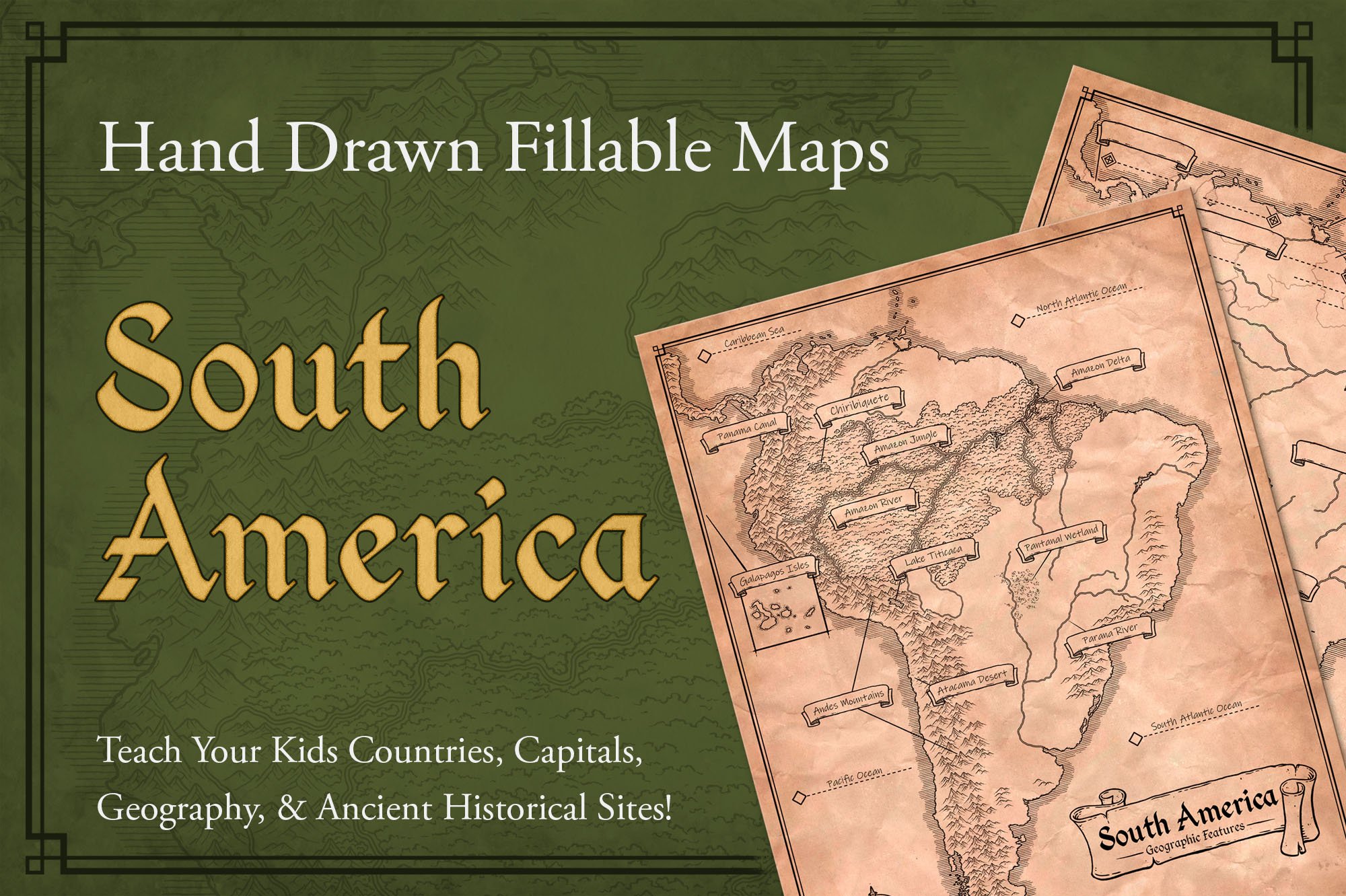
South America
Hand Drawn Fillable Map to Teach Your Kids Countries, Capitals, Geography, & Ancient Historical Sites!
$4
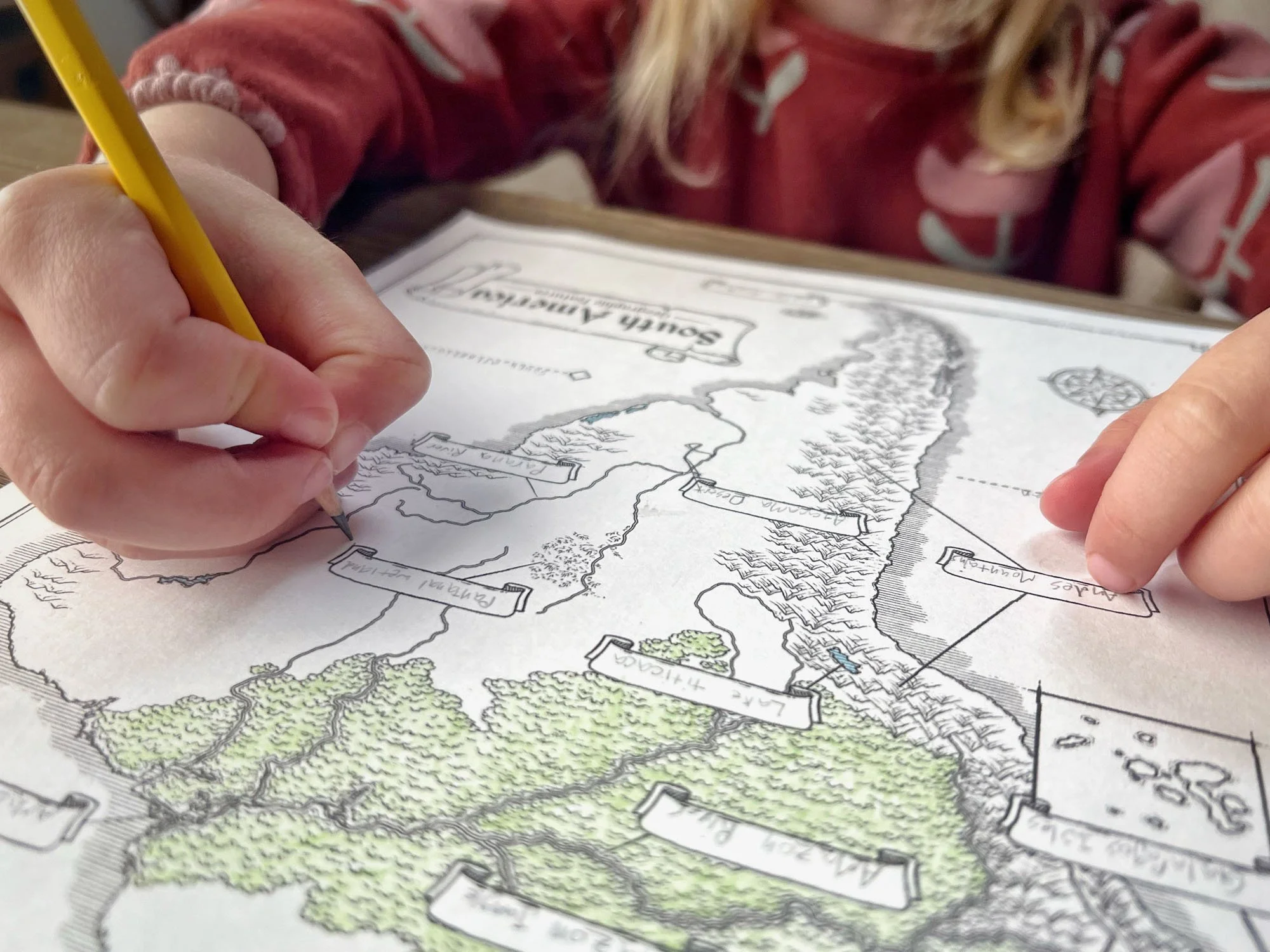
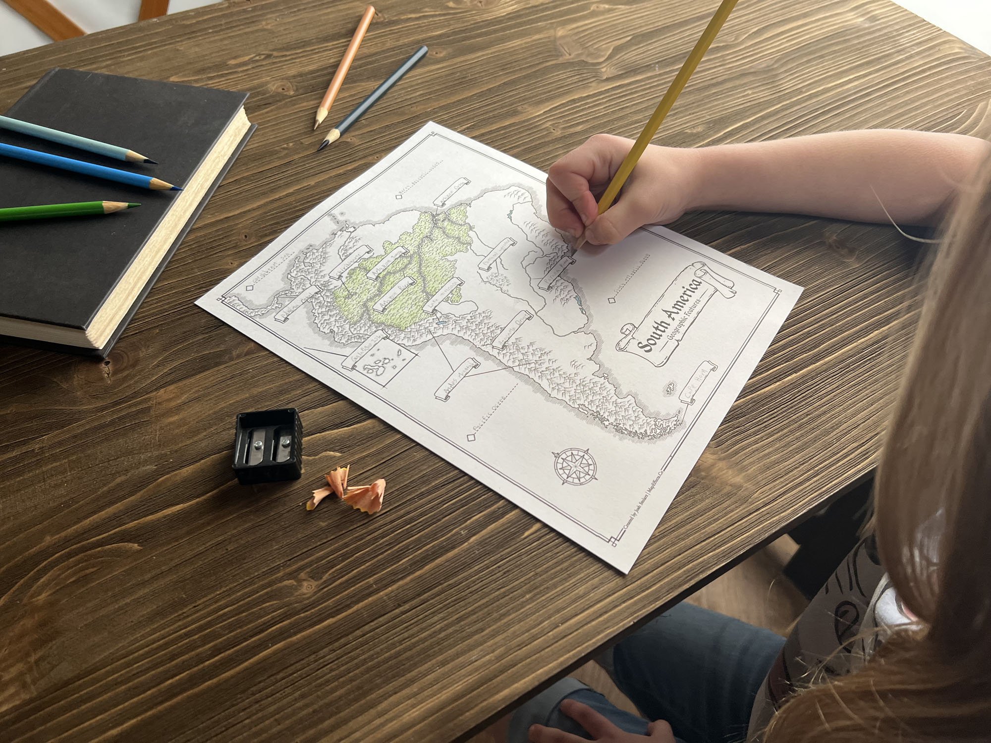
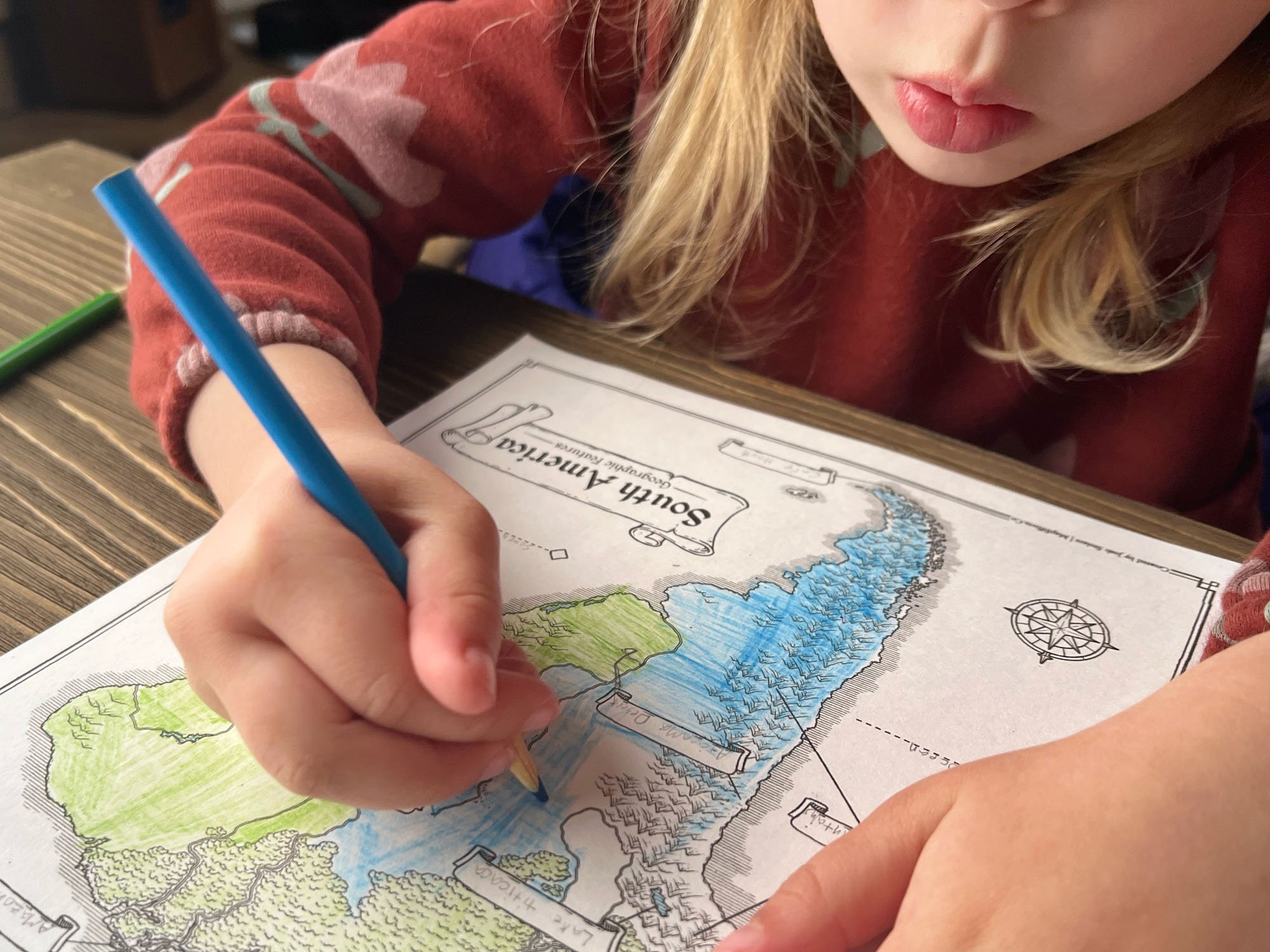
Say goodbye to the dull, sterile maps found in most geography curriculums and rediscover the charm of hand-drawn maps, reminiscent of those crafted by explorers during the Age of Exploration. Ignite a sense of wonder as your kids dive into South America’s countries and capitals, marvel at geographical wonders like the Andes Mountains and Amazon Jungle, and uncover ancient historical sites like the cities of the Inca Empire. More than just a learning tool, they turn geography into an exciting treasure hunt, drawing kids in with every intricate detail. The hand-drawn style doesn’t just captivate—it beckons them to grab their colored pencils, shade in the landscapes, and transform each map into a personal work of art.
This isn’t just a resource; it’s a launchpad for the next generation of explorers! Filling in names and coloring these maps offers a tactile, immersive way to connect with geography, and you might even catch your kids sketching their own maps, dreaming up worlds of their own. With three distinct versions included, this creative, high-quality set makes learning fun, memorable, and deeply engaging. Give your kids an excitement for the cultures and history of South America as they color, explore, and perhaps draw their way to a lifelong passion for geography!
As a homeschool parent who has always loved geography, history, and art, I was consistently disappointed by the maps in the curricula we used to teach our kids. Fortunately, one blessing of homeschooling is that I could do something about it. My kids enjoyed it so much, and I saw a new spark for learning ignite in them, that I decided to create this product to share with you. I pray it does the same for you and your family.
- Josh Stolarz
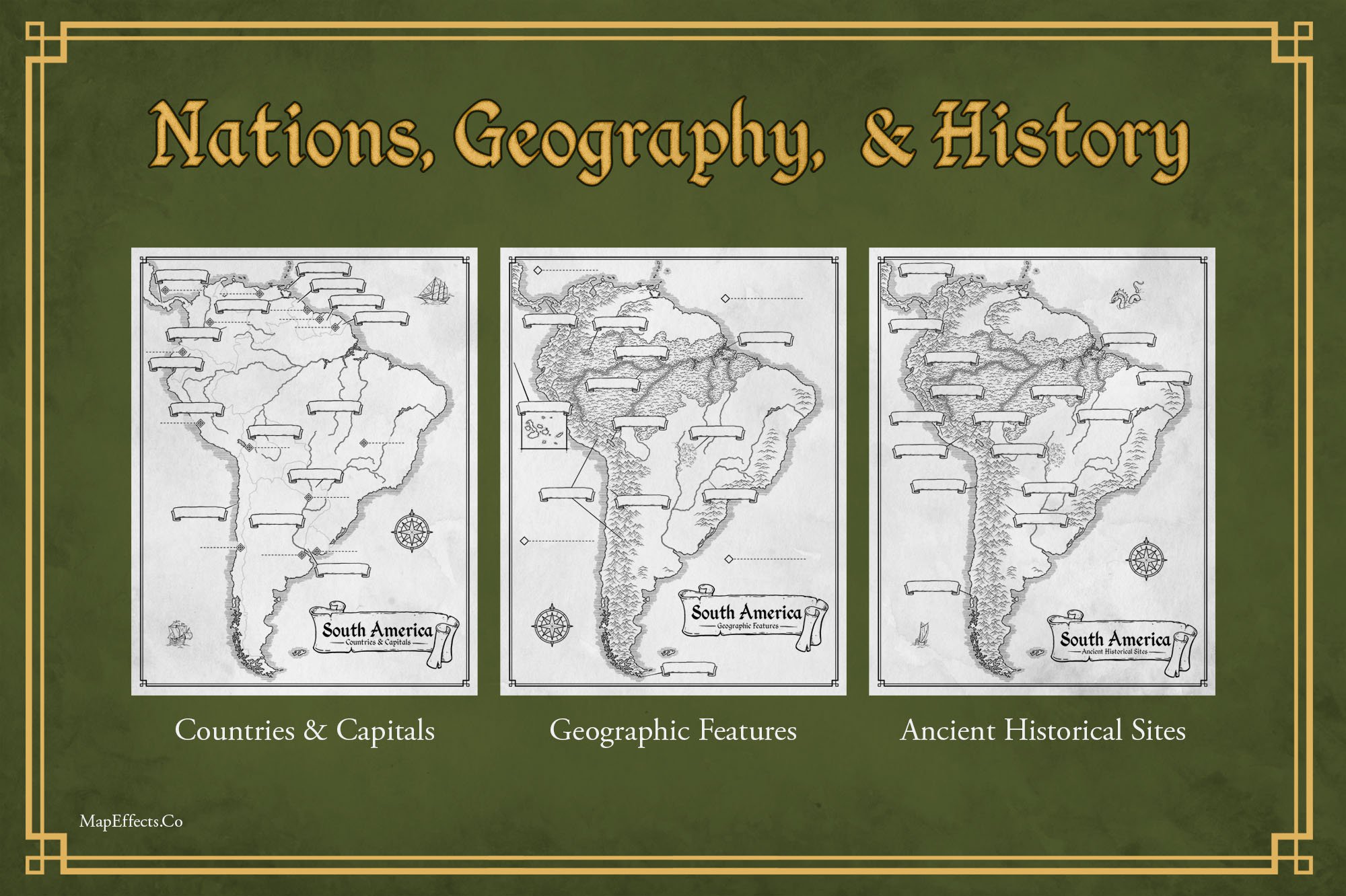
Here’s What You Will Get
3x High Resolution PDF Maps - Print Size 8.5x11” - Actual Size 17x22” 300dpi
Countries & Capitals Map - Blank & Answer Versions
Geographic Features Map - Blank & Answer Versions
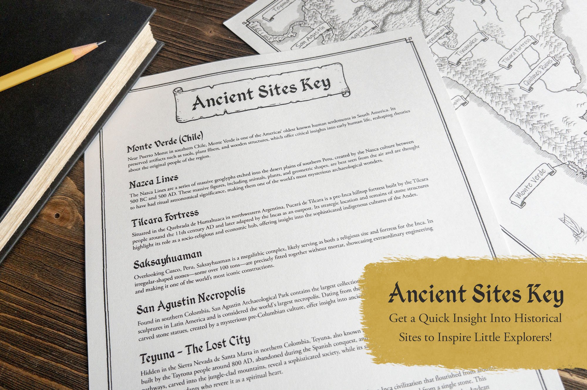
Ancient Historical Sites Map - Blank & Answer Versions
Ancient Historical Sites Descriptions to Inspire Further Learning
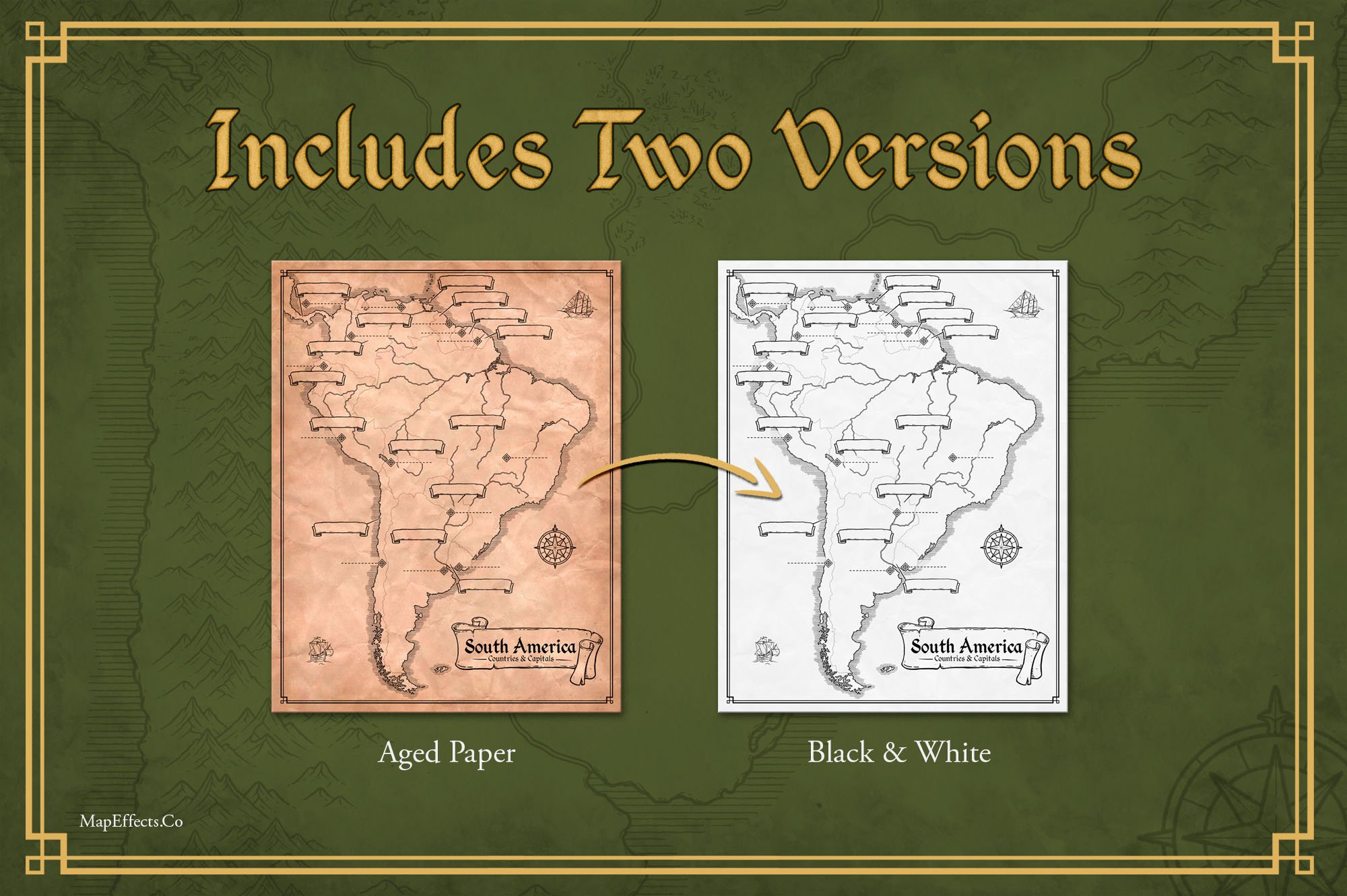
Aged Paper & Black and White Versions of All Maps
Illustrated by Josh Stolarz
This Product is a PDF Download
File Download Size: 270 MB


FAQ
-
You’re free to use these maps for personal use in your own household or within a single classroom setting (like your homeschool or traditional classroom). However, please don’t redistribute or resell the contents of this product in any digital or physical form—keeping it exclusive helps me continue creating resources like this for families like yours!
-
YOU MAY ALSO LIKE
Historical Effects Bundle
$29 | $35

